









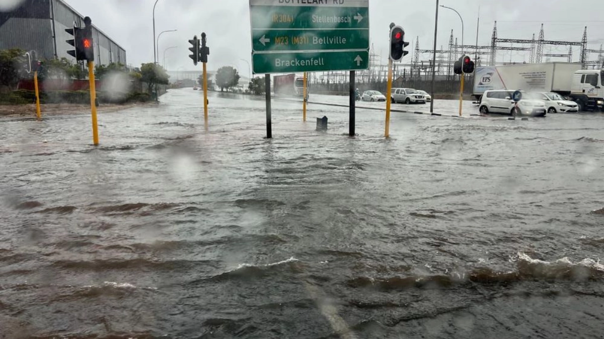
The Western Cape is facing another dangerous bout of severe weather after a deadly storm earlier this week left one person dead, displaced residents across several municipalities and forced repeated school closures. The province has now strengthened disaster readiness measures as two more intense cold fronts move in, with the South African Weather Service warnings carried by government including an Orange Level 8 alert for disruptive rainfall in parts of the Cape Winelands.
The stronger and more accurate angle here is not that South Africa has just declared a new national disaster over this specific Western Cape storm. The official record reviewed does not show that. What it does show is a province operating in full disaster-response mode, with the Provincial Disaster Management Centre on high alert, emergency shelters opened, roads affected, and schools closed in the interests of safety.
What we know so far
The Western Cape government said on 7 May that the intense weather system that swept across the province had already caused one death. Acting Premier Ivan Meyer said Lauren Fredericks, a social auxiliary worker at the Western Cape Department of Social Development, had died, while numerous incidents of localised flooding were reported and several roads remained closed.
The same official update shows the impact was already severe before the new wave of weather arrived. The province said emergency shelter, food provision and support services had been activated in several municipalities. Bitou had about 58 people sheltered at Kranshoek Griqua Church and another 138 at Wittedrift Community Hall, with more people accommodated at other community halls. Knysna had around 200 people being housed at a local church, Oudtshoorn had 25 people in Toekomsrus Community Hall, and Prince Albert had 80 displaced people in Klaarstroom.
That was followed by a fresh escalation in risk. On 8 May, the Western Cape government said it had strengthened readiness as another two cold fronts approached from Sunday to Tuesday. In that statement, government said SAWS had issued an Orange Level 8 warning for rainfall accumulation of 100mm to 200mm along the escarpment, affecting municipalities such as Drakenstein, Stellenbosch, western Theewaterskloof, Breede Valley and Witzenberg, with some mountainous areas potentially receiving 200mm to 300mm.
The province also said an Orange Level 6 warning had been issued for strong to gale-force coastal winds with gusts of 100 to 120km/h, an Orange Level 5 warning for damaging interior winds in parts of the Cape Winelands and western Central Karoo, and a Yellow Level 2 warning for disruptive snowfall over high-lying areas. Municipalities and response agencies were told to prepare for flooding, road closures, wind damage and disruptions to essential services.
Why it matters
The most immediate public impact is on schooling and travel. A Western Cape Education Department letter dated 10 May says schools in circuits 3, 4, 5 and 6 of the Cape Winelands Education District were closed on Monday, 11 May 2026 after consultation with provincial disaster risk management and the weather service. All learner transport into and around those areas was also suspended. The same notice says an additional 11 schools in Eden and Central Karoo were authorised to close because of ongoing transport and infrastructure problems from the previous storm.
The attached WCED list shows the scale of the closures. The affected circuits include a long list of schools across De Doorns, Worcester, Ceres, Tulbagh and surrounding areas in the Cape Winelands, in addition to selected schools in Eden and Central Karoo. This is no minor precaution for a handful of campuses. It is a broad disruption aimed at keeping learners and staff off dangerous roads and out of flood-prone areas.
There is also a wider disaster-management significance. Earlier in the week, the Provincial Disaster Management Centre had already placed the province on high alert when the first Orange Level 8 rainfall warning was issued for the Garden Route. Government said rainfall totals of 150mm to 200mm were possible in that phase, with risks including flash flooding, mudslides, dangerous waves and strong to gale-force winds.
This means the current storm story is not only about bad weather. It is about repeated system stress on schools, roads, shelters, local government and emergency services in a province already dealing with damage from the first round of severe conditions. When fresh fronts arrive before recovery is complete, the danger compounds, especially in low-lying communities, flood-prone settlements and areas where access roads are already blocked or damaged.
Key details and figures
Several numbers show the seriousness of the situation. The 7 May provincial update recorded one death and hundreds of displaced residents across Bitou, Knysna, Oudtshoorn and Prince Albert. It also recorded at least 10 people cut off by floodwater in Oudtshoorn, though not said to be in immediate danger at that time, and said a rescue operation near Beaufort West had successfully assisted two adults and two children trapped by rising water.
The current forecast risk is also unusually high. The 8 May government statement says the latest Orange Level 8 warning covers rainfall accumulation of 100mm to 200mm, with some mountainous areas possibly reaching 200mm to 300mm. Coastal winds were forecast to gust between 100 and 120km/h, with wave heights rising as high as 6.5m to 7.5m on Monday.
On the education side, the WCED says all learner transport into or around the closed Cape Winelands circuits was suspended for 11 May, while all other schools across the province would remain open unless separately authorised to close. The department also said principals must report storm-related damage immediately so that support and intervention can be arranged.
These details matter because they show the province is dealing with both immediate life-safety threats and cascading public-service disruption. The storm has already moved beyond a weather warning into a governance and humanitarian problem, even without a fresh national disaster declaration attached to this particular system.
What happens next
The next step is continued emergency coordination while the weather system moves through. The Western Cape government said disaster coordination mechanisms had been activated across all districts and the City of Cape Town, with all disaster management centres placed on high alert. Residents were urged to monitor official communication channels, avoid unnecessary travel, and exercise caution near rivers, bridges and coastal areas.
For schools, the immediate plan is limited and conditional. The WCED letter says the affected Cape Winelands schools are scheduled to reopen on Tuesday, 12 May, but that depends on conditions improving enough for travel and access to be safe. In other words, reopening is the intention, not a guaranteed outcome regardless of storm damage or flooding.
For now, the safest conclusion is narrow and factual. The official record supports a severe weather emergency in the Western Cape with deadly consequences, large-scale displacement and school closures across affected districts. It does not currently support saying a new national disaster has been declared over this specific storm.