







The South African Weather Service has an Orange Level 6 warning in place over the northern and eastern half of the Free State on Monday, alongside Yellow Level 2 warnings running across four more provinces.
The number in a SAWS weather warning does not describe how much rain is coming. It describes how confident forecasters are that the damage will actually happen, and that distinction changes what the warning is asking of people on the road.
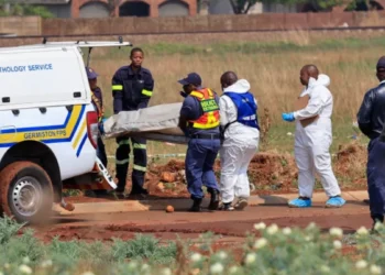
The warnings follow a weekend in which an intense cut-off low pressure system submerged vehicles in the Johannesburg CBD, closed streets across the city, blew roofs off houses in two provinces and damaged three schools.
Severe thunderstorm warnings were valid from 6 to 7 September. SAWS reissues and adjusts warnings through the day, so the position at the time of reading may differ from the position at the time of writing.
Where the SAWS weather warning applies on Monday
The Orange Level 6 warning for severe thunderstorms covers the northern and eastern half of the Free State. SAWS lists the expected impacts as “flooding of settlements and roads, strong gusty wind and hail”, along with travel disruption and municipal service outages.
The Yellow Level 2 warning for severe thunderstorms covers southern Gauteng, the Mpumalanga Highveld, southern and central North West, the northern parts of the Free State and places in the extreme north-eastern Northern Cape. Expected impacts there are localised damage to structures, falling trees and fire incidents caused by excessive lightning.
Broadcast and online reports on Monday morning also carried an Orange Level 5 warning for Gauteng excluding the Tshwane metro, with a stated 60% probability and threats listed as damaging winds, hail and excessive lightning. That is a later and separate warning from the Yellow Level 2 in the Sunday evening bulletin.
Rainfall of between 30mm and 50mm is possible in affected areas, with winds above 40km/h and stronger gusts.
What Orange Level 6 means for a Monday commute
Orange is the middle of three warning colours and signals significant to severe impacts. On the ground that means standing water on roads, hail, lightning and the possibility that municipal services go down.
The practical instruction from emergency services has not changed since the weekend. Johannesburg Metropolitan Police Department spokesperson Superintendent Xolani Fihla put it plainly on Sunday: “If you encounter submerged roads or high standing water, turn around immediately.”
Fihla said stalled vehicles block emergency access and create further hazards. Motorists were urged to drive well below the speed limit, extend following distances and keep headlights on.
Robert Mulaudzi, spokesperson for the City of Johannesburg Emergency Management Services, said specialised water rescue units and disaster monitoring teams were on high alert across Gauteng because of slippery roads and rising water levels. He urged residents to “avoid crossing rivers and streams, monitor young children and stay away from drainage systems”.
Incidents in Johannesburg can be reported to the city’s Emergency Call Centre on 011 375 5911. Southafriworld has covered an earlier Level 6 warning for South Africa and the pattern of disruption is consistent.
The number is confidence, not rainfall
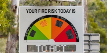
This is the part of the system almost no coverage explains. SAWS builds each warning from a matrix that combines how bad the impact would be with how likely forecasters think that impact is. The colour carries the severity. The number carries the confidence.
That is why an Orange Level 5 and an Orange Level 6 can describe the same kind of storm. The 6 simply means forecasters are more certain the damage will occur.
SAWS forecaster Sihle Dlamini has explained the bands using the significant impact row: “For medium likelihood, which is 60% and still sitting on significant impact”, the result is an Orange Level 5. A very low likelihood of around 10% would produce a Yellow Level 3, and a low likelihood of around 30% a Yellow Level 4.
The full matrix works as follows.
| Level | Colour | Impact if it happens | Likelihood it happens |
|---|---|---|---|
| 1 | Yellow | Minor | Medium |
| 2 | Yellow | Minor | High |
| 3 | Yellow | Significant | Very low |
| 4 | Yellow | Significant | Low |
| 5 | Orange | Significant | Medium |
| 6 | Orange | Significant | High |
| 7 | Orange | Severe | Very low |
| 8 | Orange | Severe | Low |
| 9 | Red | Severe | Medium |
| 10 | Red | Severe | High |
Read against Monday’s warnings, the Free State Orange Level 6 is the serious one: significant impact, high likelihood. The Yellow Level 2 across the other provinces is minor impact, also high likelihood.
A Level 8 is not automatically worse weather than a Level 6. It sits higher on the severity axis but lower on confidence, which is why a Level 8 alert over the Garden Route earlier this year carried a different kind of instruction.
What the weekend storms already did
The damage is not hypothetical. Localised flooding at the intersection of Siemert Road and Currey Street in Doornfontein left several vehicles submerged on Sunday afternoon, with JMPD officers diverting traffic away from the scene.
The JMPD reported closures at Cooper and Beryl streets in Cyrildene, Beatrice and Princess avenues in Windsor, and Smit Street and 11th Avenue at the M1 on and off ramps. A tree fell onto a JMPD vehicle in Witpoortjie on Saturday.
In Setlagole, a village more than 70km outside Mahikeng, strong winds tore roofs off homes and rain damaged interiors. Lerato Gambu, spokesperson for North West Cooperative Governance and Traditional Affairs, said one learning centre and two primary schools were also damaged, and Eskom reported power interruptions in parts of the province.
The North West Provincial Disaster Management Centre activated coordinating structures across all district municipalities. In the Northern Cape, residents in the Sol Plaatje Municipality reported roofs blown off and household goods damaged. Road disruption on this scale is a recurring cost, as August’s snow warnings and road closures showed.
When it clears, and the system behind next weekend
SAWS forecaster Lehlohonolo Thobela said conditions are expected to start improving from Tuesday, with thunderstorms becoming isolated over Mpumalanga, Gauteng, KwaZulu-Natal and Limpopo. By Wednesday, he said, no precipitation is expected over the central and eastern parts of the country.
Thobela has also flagged a second cut-off low as a possibility for next weekend. That is an outlook rather than a warning, and no warning level attaches to it yet.
Several things remain unconfirmed. Southafriworld could not load the SAWS warnings page directly, because it renders through scripts the fetch could not execute, so the warning texts here are as published by outlets carrying the SAWS bulletin. The relationship between the Sunday evening Yellow Level 2 for southern Gauteng and Monday’s reported Orange Level 5 for the province has not been clarified by SAWS in any published statement reviewed.
The reliable position is the live one. Warnings are published on the SAWS website and its official channels, and they change during the day as forecaster confidence shifts. The last comparable September system left Meiringspoort shut by flooding, and the closures this weekend were announced with no advance notice at all.